
No, not that type of cone LOL !
You may have noticed the tagline under our logo (HD the turtle):
Helping You Prepare for the Cone of Uncertainty
The National Hurricane Center (NHC) was concerned that some people were watching weather on TV or online and only taking notice (and preparing) if the eye or center of the storm went right over where they lived. They were following only the track line.
The problem is, hurricanes and tropical storms can be hundreds of miles in diameter, affecting huge areas far from the center. So to fix this, NHC defines the area of a cone as the probably track of the center of the storm system. Instead of drawing the old fashioned line, the NHC computer models place a circle at 12 hour increments, making them grow larger the further out in time. This factors in the error rate of the models.
For more technical detail visit NHC here
Several recent examples
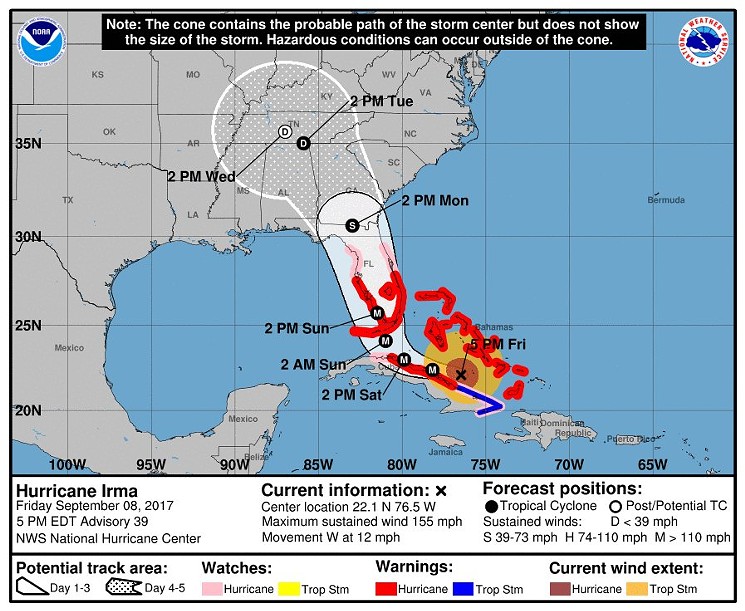
The cone of uncertainty probably does get peoples attention, but it can also seem very frustrating and confusing as well. In the following NHC map for hurricane Irma in 2017, this cone put practically the entire state under the bulls eye. I know because we lived through it all.
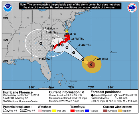
This second example of the cone for Hurricane Florence in 2018 was equally distressing. The coastal areas of multiple states evacuated. I experienced this by making a 19 hour round trip marathon drive from Florida to South Carolina and back, getting my mother out before the mandatory evacuations!
My point here is that even the most sophisticated weather forecasting models can not exactly predict the path of a storm. This means that we should all prepare well in advance of any particular storm threat.
Preparing early reduces a lot of the uncertainty… at least the part we can control.